|
Salt Axis
Franz John - Sculpture-Biennial Münsterland, Germany (2005 )
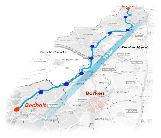
The subterrestrial salt deposits in western Münsterland stretch ca. 50 km along a north-south axis near the Dutch border. Near the town of Epe, they have a relative thickness of 400 meters; this sinks in the area of Ahaus/Vreden to ca. 100-200 meters, then re t u rning then to a level of 400m near Bocholt. In geohistorical terms, these salt deposits can be traced back to a prehistoric sea that dried up 200 million years ago. My goal in this art project is to explore the extent of the salt deposits across all of western Münsterland, and in so doing also investigate the interwoven history of salt as a commodity. For the artistic interventions, eight sites will be chosen along a currently existing bike
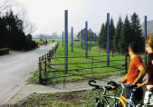
path connecting Gronau and Bocholt; these sites can thus be experienced using a means of transportation typical for the region. The bicyclist thus moves along a hidden salt path through the region, past brine salt pumps and pipelines, drilling stations, historical salt routes, and underg round salt deposits. In this way, this art road," in a sense a metaphorical "Salztangente" 1 is able to link the history of the region with the special topography of a both supert e rrestrial and subterrestrial landscape (tangere = Latin for to touch").
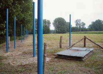
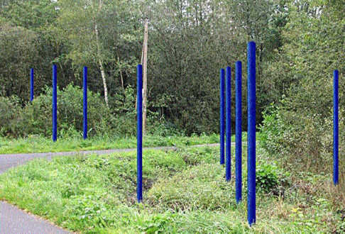
The basic idea is to introduce a new level of perception and meaning into the landscape, using rods or fields of rods along the salt deposits in the region to symbolize the surface" of the dried out ocean as a constant elevation (ca. 3 m over the average elevation of 45 meters above sea level). At the same time, the rods will be colored to correspond to the local subterrestrial salt deposits, thus providing a partial view of the earth's interior. The colors are taken from the grays and blues of a geological map showing the underg round salt deposits of the region. The distance between the rods in the installation will correspond to the to the distance between the profile grids of modern geophone measurements that precede salt drilling.
1 The German word Tangente refers not only to a tangent in the strict geometrical sense, but is also used to designate main thoroughfares: "an east-west Tangente" or "axis" through a city, for example.
|